La Roque-sur-Cèze
308 Km de voiture depuis Nice
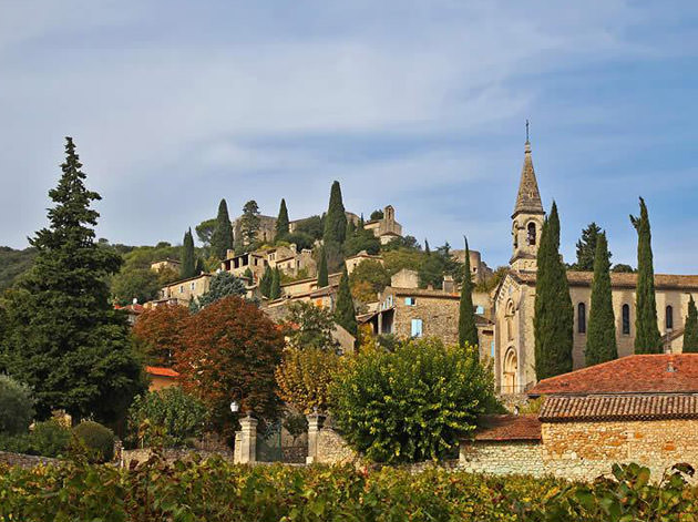
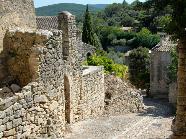
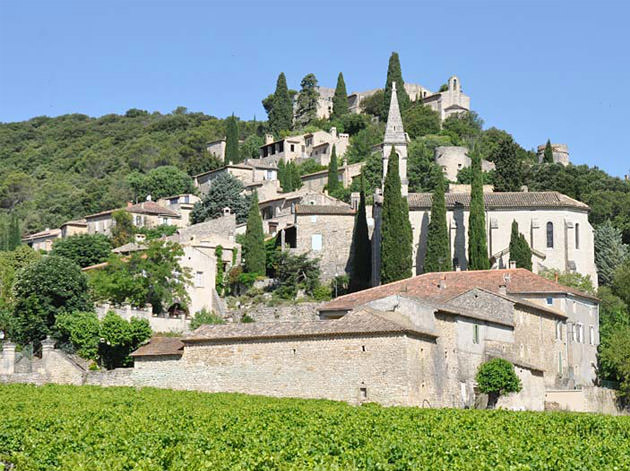
Au nord du département du Gard, La Roque-sur-Cèze s’est construit sur un piton rocheux en surplomb de la Cèze qu’enjambe un vieux pont à douze arches. Dominé par les vestiges d’un ancien château et sa chapelle romane, le village aux calades pentues et maisons de pierres blondes à génoises offre une vue imprenable sur les cascades du Sautadet, un site naturel exceptionnel qui ajoute à l’attractivité du lieu.
La Roque-sur-Cèze
308 Km by car from Nice
At the North of Gard, La Roque-sur-Cèze was built on a rock peak overlooking the Cèze which spans a twelve-arches old bridge. Dominated by the traces of the former castle and its chapel, the village with sloping cobbled streets and its houses, made with creamy stones and curved-tiles cornices, offers a breathtaking view of the Cascades du Sautadet, an exceptional natural site which adds to the attraction of the place.
Wikipedia
Geo Data
- Latitude: 44.1933720 (44° 11' 36.14'' N)
- Longitude: 4.5184380 (4° 31' 6.38'' E)
- Elevation: Min. 50 m – Max. 247 m
- Demonym: Roquairols, Roquairoles
- Population (2014): 179
- Density: 21 hab./km²
- See La Roque-sur-Cèze French Riviera on Google Map
- GPX eXchange format
- Google Earth Pin
- KML Syntax
- It's 00:00:00 in New York, 00:00:00 in London, and 00:00:00 in La Roque-sur-Cèze.